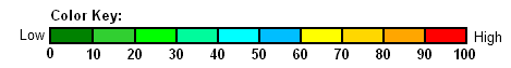
The Dry Thunderstorm Index (DTI) is designed to give ODF METEOROLOGISTS a “heads up” as to when and where dry thunderstorms (storms that produce little or no rain at the surface) are likely to occur in Oregon. It is a probability expressed in percent (from 0 to 100). The DTI combines the predicted probabilty of thunderstorms concurrent with the probability of measurable rain. Higher numbers indicate a greater chance of the occurrance of dry thunderstorms. When the DTI is high, this is a signal for ODF METEOROLOGISTS to alert field personnel to the increased risk of new lightning-caused fires in their respective areas.
The DTI is ONLY INTENDED FOR USE BY ODF METEOROLOGISTS. IT HAS NOT BEEN SCIENTIFICALLY TESTED. It is locally and arbitrarily computed as follows:
        DTI = Dry Thunderstorm Index, a probability expressed as a percent (0-100)
        T24 = Probability of Thunderstorms (0-100) for the 24-hr period ending at 12Z the following morning (from GFSX MOS Guidance)
        P12 = Probability of measurable rain (0 to 100) for the 12-hr period ending at 12Z the following morning (from GFSX MOS Guidance)

        DTI = round(T24 * (100-P12)/100)
Note: The DTI MATRIX uses numerical guidance (MOS) from the National Weather Service (NWS) but is not a product of the NWS.